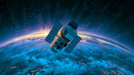
- A geostationary orbit holds satellites fixed at 35,786 km above the equator.
- Weather, TV, and military systems depend on this fixed vantage point.
- Arthur C. Clarke proposed the concept in 1945; Syncom 3 proved it in 1964.
A geostationary orbit is a circular path around Earth at an altitude of 35,786 kilometers above the equator, where a satellite completes one orbit in exactly the same time the planet takes to rotate once. From the ground, the satellite appears motionless, fixed at a single point in the sky.
Why It Matters
Geostationary satellites underpin much of modern infrastructure. Weather agencies operate fleets of them: NOAA's GOES satellites, the European Meteosat series, and Japan's Himawari all sit in geostationary positions, delivering continuous imagery of the same swath of atmosphere. Without that fixed vantage point, tracking a developing hurricane hour by hour would require stitching together data from multiple passing satellites.
Key figure
35,786 km
Altitude above the equator where orbital period matches Earth's rotation
Telecommunications depend on geostationary orbit just as heavily. Direct-broadcast television, maritime communications, and military relay systems all route signals through GEO satellites because ground antennas can point at a fixed spot rather than tracking a moving target. The risk of satellite collisions in increasingly crowded orbital lanes makes managing this altitude a growing concern.
How It Works
The physics is a balance between gravity and centripetal acceleration. At 35,786 km above the equator, Earth's gravitational pull and the centripetal force required to maintain a circular orbit produce an orbital period of 23 hours, 56 minutes, and 4 seconds, one sidereal day. The satellite travels at 3.07 km/s relative to Earth's center, matching the planet's rotation exactly.
Key figure
3.07 km/s
Orbital velocity at geostationary altitude
Three conditions must all hold: the orbit must be circular (zero eccentricity), equatorial (zero inclination), and prograde (moving west to east, the same direction Earth rotates). If any condition is off, the satellite drifts relative to its assigned longitude. Operators burn small amounts of fuel, called stationkeeping maneuvers, to correct for gravitational perturbations from the Moon, the Sun, and the slight asymmetry of Earth's own mass distribution.
The geostationary belt is a finite resource. The International Telecommunication Union allocates orbital slots, typically spaced 2 degrees apart, giving roughly 180 usable positions around the equator. Satellites at end of life are boosted into a graveyard orbit about 300 km higher to free their slot and reduce collision risk.
Key Context
Arthur C. Clarke described the concept of geostationary communication relays in a 1945 paper, "Extra-Terrestrial Relays," published in Wireless World. He proposed that three satellites spaced evenly around the equator could provide radio coverage for the entire planet. The International Astronomical Union now formally designates the geostationary altitude as the Clarke Orbit in his honor.
The idea took 18 years to reach hardware. NASA launched Syncom 2 in 1963, the first satellite to achieve a geosynchronous orbit (though slightly inclined). Syncom 3, launched in 1964, achieved a true geostationary position and broadcast the Tokyo Olympics live across the Pacific.
FAQ
What is the difference between geostationary and geosynchronous orbit?
Every geostationary orbit is geosynchronous, but not every geosynchronous orbit is geostationary. A geosynchronous satellite has a 24-hour orbital period but may follow an inclined or elliptical path, tracing a figure-eight pattern over the ground. A geostationary satellite adds two constraints: zero inclination and zero eccentricity, keeping it fixed above one equatorial point.
Why must geostationary satellites orbit above the equator?
Only an equatorial orbit allows the satellite's orbital plane to align with Earth's rotation axis symmetrically. Any inclination would cause the satellite to drift north and south of the equator over the course of a day, making it appear to move from the ground.
How does signal latency affect geostationary satellite communications?
A round trip from Earth to geostationary altitude and back covers about 71,600 km. At the speed of light, that introduces a minimum delay of roughly 240 milliseconds. For voice calls, this is perceptible. For financial trading, it is disqualifying, which is one reason fiber optic cables remain the backbone of high-frequency networks.
How many satellites are currently in geostationary orbit?
Approximately 570 active satellites occupy geostationary orbit as of early 2026. Hundreds of defunct satellites and rocket stages also remain in nearby orbits, contributing to the growing challenge of space debris management at this altitude.
Sources
- Primary Reference: Types of Orbits (European Space Agency)
- Historical: Extra-Terrestrial Relays (Arthur C. Clarke, Wireless World, 1945)
- Additional Context:
- First Practical Concept of Satellite Communications (IEEE Communications Society)
- Clarke Suggests Geosynchronous Orbit (Engineering and Technology History Wiki)
- Geostationary Orbit (Wikipedia)

Fact Check: Claim-by-Claim Verification Verified
All core claims verified against authoritative sources including ESA, NASA, IEEE, and Wikipedia. Orbital parameters, historical dates, and satellite counts confirmed accurate.
Sources used for verification
- Types of Orbits - esa.int
- Geostationary Orbit - wikipedia.org
- First Practical Concept of Satellite Communications - comsoc.org
- Clarke Suggests Geosynchronous Orbit - ethw.org
- Geostationary satellite latency - satsig.net